What’s wrong with this map? What’s right? What’s just? Who decides? Who benefits?
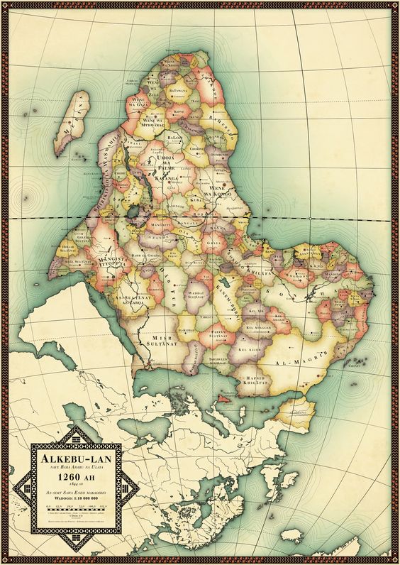
Maps are important ways to perpetuate a Big Lie. Here is Africa from a fresh perspective.
Alkebu-lan is Arabic for “Land of the Blacks.” The map above uses familiar color and shading schemes to name the distinct cultures and people. Human geography.
Zoom in and experience the fractal quality of intense diversity:

The unlabelled land mass at the bottom is the uninhabited realm of lands depopulated by an extinction level event such as Black Death: an alternate history suggested by Frank Jacobs elucidated here:
Africa, Uncolonized: A Detailed Look at an Alternate Continent
A few interesting land areas stand out: places Empire Expanders call Sinai, Levant, Sicily and Spain. Their unexpected presence gives pause.
Please look at this planet from the Other’s perspective, remembering that you too are the “Other.” Call me Ishmael.
The equator is the dashed line. To my eye that great lake in Alkebu-lan looks like a chick’s eye. What a strikingly different way to look at this enormous continent. The solar system doesn’t have a top and bottom, so I can just imagine visitors from another star system mapping the southernmost continent as the top of the third planet out.
The Latin for the interior sea is Mediterranean: the sea at the middle of Earth. It’s natural but unfortunate to look at the world from where you name “us.” It could be New York or the Middle Kingdom (China) or Middle Earth.
Anywhere, really.
America must not remain the center for geopolitical advantage studies.
The land of the fulsome and the home of the nice.
Imperialism is brutal exploitation of a land and its people: gain without pain for the well armed and the already comfortable.
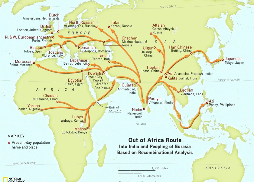
Here are the paths the genomes took.
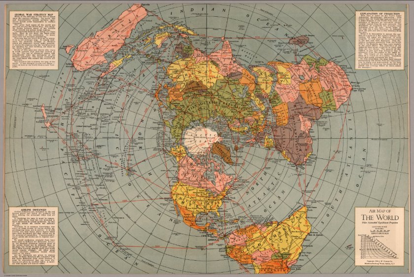
Simply stated, a map projection is a compromise achieved by forcing a sphere in three dimensions onto a two-dimensional surface. Only a globe presents accuracy to scale on behalf of the earth orb, but you can only see one side of the globe at one time. And it doesn’t fit well in your pocket.
When you have looked at the same combination of continents 100,000 times or so, it gradually takes on the ring of “truth.”
Consider the azimuthal equidistant projection for establishing a center point anywhere. It’s the polar opposite (figuratively and literally) of the mercator projection. Mercator places the North Pole at infinity. Azimuthal places Santa’s Workshop at the center of the world.
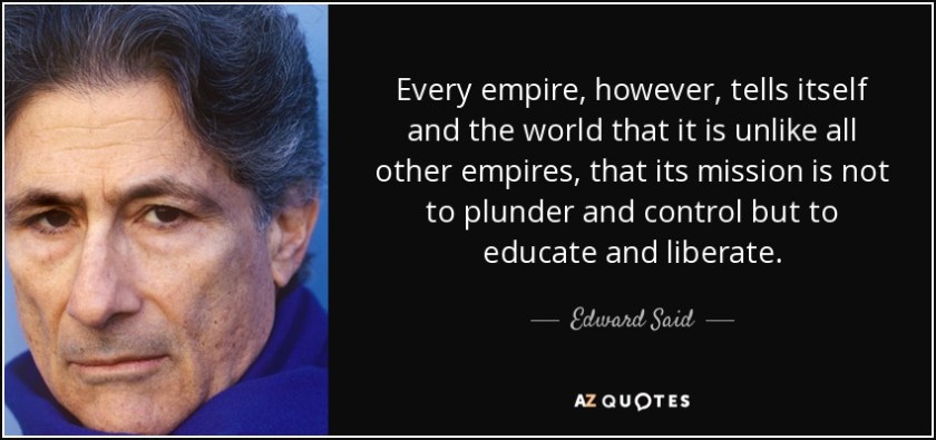
Expect maps to push agendas hard. In 1978 the Palestinian-American scholar Edward Said produced the book Orientalism,in 1978. It explains the way an occupation force imposes its perspective on the occupied: imposition of language and Eurocentric concept of unchangeable truth.
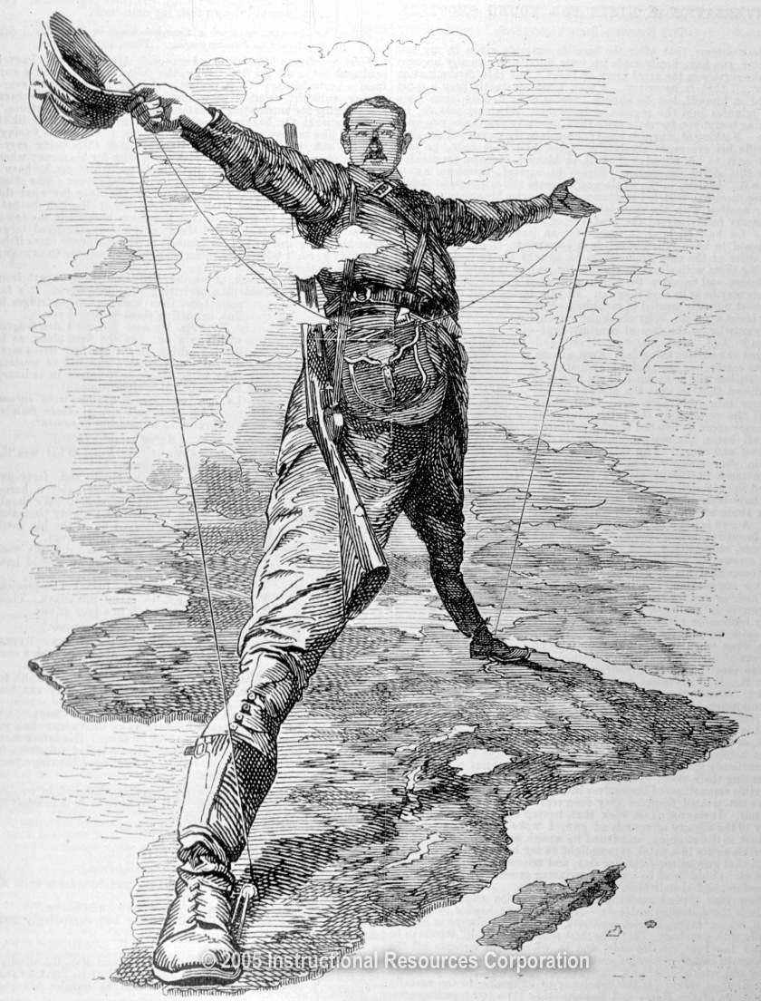
From Allen Webb, my source for Cecil Rhodes, a quote from gentle Cecil:
We must find new lands from which we can easily obtain raw materials and at the same time exploit the cheap slave labor that is available from the natives of the colonies. The colonies would also provide a dumping ground for the surplus goods produced in our factories.
The British imperial overlords used a straight-edge to define borders for the people they exploited before leaving former colonials to sort it all out. Once they left they didn’t look back. What’s past is passed. Let’s just say ‘we’re history.’
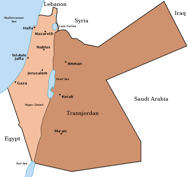
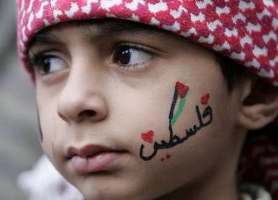
Consider the absurd British decision to create an East and a West Pakistan in the South Asia theater of interest and profit. It’s folly most insane. Lord Balfour had as much insight as the architects of East and West Pakistan when he crafted a 67-word statement in 1917. Nakba is one result. Truth is one casualty.
I mention alternate histories. Here is one such at DeviantArt.Net, a resource for speculative art.
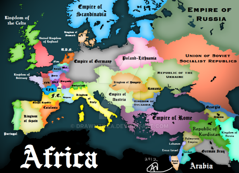
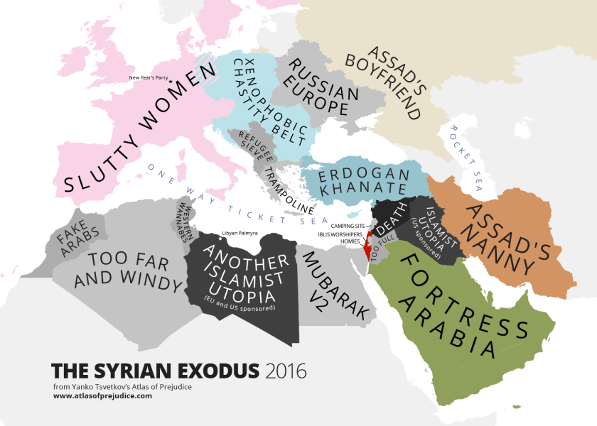
Keep a window open for Yanko Tsvetkov, the cartographer for the indispensable Atlas of Prejudice.
Thanks for reading.
