Accordant Summits and Newton’s Laws

I love maps, all my life they’ve whispered to me. I spin imaginary globes in my mind and imagine a sphere metamorphosing from three dimensions to two in arcane and artful ways.

Lines of longitude and latitude: which is which? Here is a mnemonic to help:

Lines of latitude are like the rungs of a ladder extending from Equator to Pole. The ladder rungs connect along the long lines of longitude (left and right side of the ladder). There’s something curious about that ladder — it connects to a single point at the top or bottom of the Earth.

The Mercator Projection takes the two points of the two terrestrial poles and stretches them from zero to infinity. A Mercator projection was designed for one thing only, and though that one use is obsolete,  Mercator dies on.


USGS topographic quadrangles describe a rectangle representing 7.5 minutes of arc. A quadrangle at the Equator is a square, a quadrangle at the North or South Poles is a triangle.

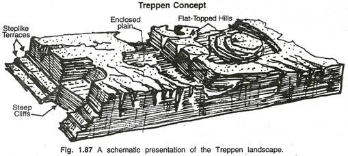
You can trace landscapes on a paper topographic quadrangle. There is a symbol available for every conceivable landmark, including the occasional sunken ship.

Our geomorphology tour now takes us to Cincinnati, OH. I’m the guide with the microphone at the front of the bus. Here’s what I am saying:

“A gently arcing dome once defined Cincinnati’s geomorphology. The most recent glaciation crushed the entire city under a couple hundred feet of solid ice, creating a set of hills carved from that arcing dome. When you stand on any of the surrounding hills you see all the other hills: 360 degrees surrounding a central point, each separated from the others by a number of miles. The technical term is ‘accordant summits’.”

treppen.concept

Time to share a memory with you.

In the 1960’s our family would spend two-weeks in the northern oven-mitt of Michigan, we drove from Cincinnati on US Route 27  — a two-lane highway that also extends into Florida. We would unfold a free gas-station roadmap and wait for a city limit sign to appear on the horizon. I would run a black marker up the lap-held map as the drive progressed northward. A pre-cursor if you will.

There were no automobile seat belts in 1964 — each occupant had the unfettered freedom to pass directly through the windshield in a way explained by Isaac Newton. To paraphrase Isaac: an object in motion wants to just keep on moving: even when everything else stops moving.

first.law.motion

Time now for an anecdote.

We were headed to a cottage in Michigan in one of those years (1964) when no passenger vehicles came equipped with seat belts.

I’m the guide with microphone at the front of the bus again:

“My mother held my youngest sister securely in her lap, front passenger side. Shifting her position, mom leaned against the passenger-door, felt that door open and saw the rushing roadway beneath them. But my mother knew about the first law of motion. Her objective: stop two objects in motion from following the lawful course identified by Newton. She successfully moved the center of gravity leftward by shifting their inclination inward, and by yanking the passenger door to a latched state.

The moral of this anecdote: understanding physics saves  lives.”

twerking.passenger

Thanks for reading.

Junior Chills Tribute, Cambrian Explosion and the Mercator Projection

I am blessed to live among my fellow curious creatures on this orb, trotting about this world alongside ants with societies much like ours, to dolphins who exceed our intelligence and do not declare war.

Shakespeare may now be paraphrased, “let slip the dolphins of war.” The Defense Dept. discovered they could train gentle seagoing mammals for military missions. These shine a warm light upon an institution that needs better PR perhaps. Eisenhower in January 1961 recognized the dark side of the MIC.

I think our enormapendous “Defense” budget is too large by many orders of magnitude. Just saying. 

Yes it really is cool to be a citizen of our singular planet and I’m grateful for every soul reading these words with eyes or ears developed in the Cambrian Explosion.

cambrian_explosion
http://www.bio.miami.edu/dana/160/160S14_16.html

Todays visitors are from Australia, Philippines and United States. Another day when visitors from over the many seas outnumber those in the country of my present geography.

Here is the local geography. Cincinnati rests on a fluvioglacial terrace, i.e. the latest glacier passing by crunched a flat space. A great geologic arch extended from central Ohio to central Kentucky. Take a 360-degree look from a hill overlooking our downtown and you see accordant summits: all the hills surrounding the central city are at the same elevation above sea level. By the way, that link for accordant summits shows you why this blog has no click-bait: the choice for me: to be ad-free!

cincinnati.arch

Recently I discovered a fellow traveler on WordPress who has morphed the music and theme of Woody Guthrie’s “Deportees” with lyrics that blend the Palestinian spirit of the indomitable with a tragically deferred dream, Junior Chills for Palestine. The Palestinian people have not allowed humiliation by colonizers to wipe away their joy. 

Damien of Junior Chills is a fellow denizen of Earth. He lives, writes and performs in the city of Belfast, Northern Ireland,  identified by map makers as the United Kingdom and borders what the world globe tells us is the Republic of Ireland. Two of the three monotheist faiths share a common isle that unites and separates, but they work hard at achieving peace. Belfast used to make the headlines here every day.

Junior Chills tugs at values I try to express and organize in my mind. Music combined with what it is to be Palestinian today. what.it.is.to.be.palestinianThose same Palestinians were around when Woody Guthrie was hard traveling, Palestinian refugees are still living in diaspora.The American Empire is unquenchable in its appetite for domination, a thirst handily hidden under the ugly name American Exceptionalism. Be fruitful, multiply and conquer.

it.was.wrong.in.auschwitzSo much do we learn from music and photography where images share humanity. People who live in those places defined by Empire. The British Empire thought themselves bestower of blessings upon the colonized.


Why is the Mercator Projection still the default standard for maps? It’s only practical use is as a navigation aid for mariners crossing oceans. Long ago. Centuries before GPS. Greenland has about the same square kilometers as Mexico. Peel an orange and you’ll recognize how well that crap map deceives the viewer. The Mercator method takes a sphere and infinitely stretches it along a tall cylinder: every line of longitude must parallel every other line of longitude.mercator.projectionThis places the North Pole at infinity and the South Pole at infinity. The only accurately described line is the equator. It may be poetically keen to imagine Santa’s Workshop as infinitely large, but it doesn’t help us relate to our fellow citizens with their geographic relationships.


When Maps Lie by Andrew Wiseman
: Tips from a geographer on how to avoid being fooled.

It’s the method of Procrustes to force things until they fit. Empires have too much on their minds to allow people to live their lives without an overlord deciding where you belong, where you don’t belong and how to enclose different peoples in the same country. The reason: just let the natives fight it out, they matters of empire to attend.

John Cleese has an answer to a question “Why does English food suck?” “I don’t know. We had an empire to run.” So they brought back somewhat more edible fare from the colonies.

%d bloggers like this: